
Billings, Montana
Montana’s largest city, set beneath the Rimrocks on the Yellowstone River.
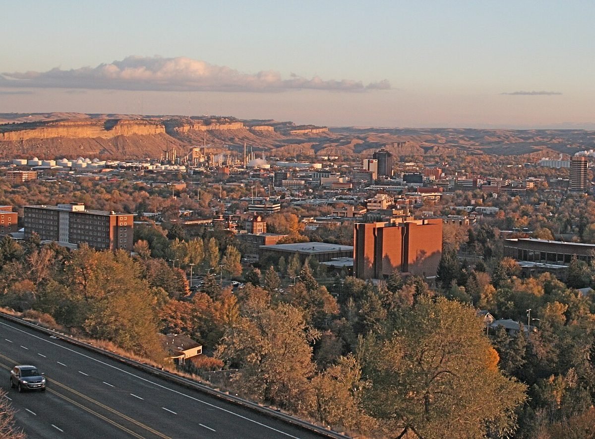
Photo: Billings and the Rimrocks: photo by Sara goth, CC BY-SA 3.0, via Wikimedia Commons, resized. All photo credits.

Last updated: October 2026
Billings is Montana’s largest city and the trade center for much of the state east of the Continental Divide (Wikipedia). It was nicknamed the “Magic City” for how fast it grew after its founding as a railroad town in 1882. Today it offers big-city shopping and medical care at some of the lowest housing costs of Montana’s major cities.
Quick facts
| County | Yellowstone County |
|---|---|
| Population | 121,239 (July 1, 2025 Census estimate); 117,116 at the 2020 Census |
| Elevation | About 3,120 feet |
| Nearest commercial airport | Billings Logan International Airport (BIL), about 2 miles straight-line |
| Distance to Red Lodge | About 53 miles straight-line |
| Climate station | NOAA: Billings Logan International Airport |
Sources: county from USGS GNIS; population from Census QuickFacts; elevation from the USGS Elevation Point Query Service at the town’s GNIS map point. Straight-line distances are calculated from Census Gazetteer town coordinates and OurAirports airport coordinates. Driving distances are longer.
What it’s like to live here
The Census Bureau estimates 121,239 residents for July 2025, up from 117,116 at the 2020 Census (Census QuickFacts).
The Rims, long sandstone cliffs, divide the city. They separate downtown from the Heights to the north and Lockwood to the east, and they rise 500 to 800 feet (Wikipedia). The Yellowstone River runs through the southeast part of town. Billings has two hospitals with Level I trauma center status, St. Vincent Regional Hospital and Billings Clinic (Wikipedia). That matters if you’re coming from a rural area or retiring here.
Because Montana has no general sales tax, Billings is a shopping destination for much of Wyoming and eastern Montana (Wikipedia).
Things to do and see
- Museums downtown. The Moss Mansion (a 1913 historic house), the Western Heritage Center, the Yellowstone Art Museum and the Yellowstone County Museum (Wikipedia).
- The Rimrocks and river parks. About 3,000 acres of parks and natural areas, concentrated along the Rims (Four Dances Natural Area, Zimmerman Park, Swords Park) and the Yellowstone River (Riverfront Park, Two Moon Park, Coulson Park) (Wikipedia).
- Pictograph Cave State Park. Three caves 5 miles south of the city. Pictographs are still visible in the largest one (Wikipedia)).
- Pompeys Pillar National Monument. A small national monument near Billings, managed by the Bureau of Land Management. Chief Plenty Coups State Park and Little Bighorn Battlefield are also in the region (Wikipedia; Wikipedia).
- Red Lodge and the Beartooths. The mountains are an easy day trip. See our Red Lodge page.
Getting around and weather
Billings Logan International Airport sits on top of the Rims, overlooking downtown (Wikipedia). Interstates 90 and 94 meet just east of downtown. There’s no passenger rail today: Amtrak’s North Coast Hiawatha stopped at the Billings Depot until 1979 (Wikipedia). Billings is the warmest of these towns in summer: the average July high at the airport is 87.3°F (NOAA, below).
Weather at a glance. These are NOAA’s 1991–2020 climate normals for the Billings Logan International Airport station (monthly, annual):
- January: average high 36°F, average low 18°F
- July: average high 87°F, average low 59°F
- Precipitation: 14.3 inches a year (rain plus melted snow)
- Snowfall: 57 inches a year
Cost of living and housing
ACS 2020–2024 figures: median home value $343,400, median gross rent $1,138 and median household income $73,712 (QuickFacts). Billings’ home values are below the Montana median of $375,800, and incomes are slightly above the state’s $72,509 (Montana).
Our Moving to Montana in 2027 guide compares Billings with the other big towns using Zillow and HUD rent data.
ACS figures are 5-year averages (2020–2024) and lag the current market. This page is general information, not financial advice.
Nearby towns
- Red Lodge, about 53 miles straight-line. Mountain town at the start of the Beartooth Highway.
- Livingston, about 97 miles straight-line. Yellowstone’s original gateway town, on the river at the top of Paradise Valley.
- Bozeman, about 121 miles straight-line. University town with ski hills on both sides and Yellowstone down the road.
- Helena, about 175 miles straight-line. The state capital, born in a gold rush on Last Chance Gulch.
Sources
- U.S. Census Bureau QuickFacts: Bozeman, Missoula, Kalispell, Whitefish, Billings and Helena (Vintage 2025 population estimates; 2020 Census; ACS 2020–2024)
- U.S. Census Bureau QuickFacts: Great Falls, Butte-Silver Bow (balance), Livingston, Polson, Hamilton and Montana (Vintage 2025 population estimates; 2020 Census; ACS 2020–2024)
- U.S. Geological Survey, Geographic Names Information System (GNIS), Montana domestic names file (county and map coordinates)
- U.S. Geological Survey, Elevation Point Query Service (3DEP elevation at the GNIS map point)
- U.S. Census Bureau, 2024 Gazetteer file for Montana places (coordinates used for straight-line distances)
- OurAirports open data, airports with scheduled service in Montana (airport coordinates)
- NOAA NCEI, U.S. Climate Normals 1991–2020, Billings Logan International Airport station (USW00024033): monthly normals
- NOAA NCEI, U.S. Climate Normals 1991–2020, Billings Logan International Airport station (USW00024033): annual normals
- Wikipedia: Billings, Montana
- Wikipedia: Pictograph Cave (Billings, Montana)
- Wikipedia: Pompeys Pillar National Monument
- Wikipedia: Pictograph Cave (Billings, Montana
All sources accessed October 21, 2026. Wikipedia is used for general background, history and attractions. For numbers, we link the official data source wherever one exists.