
Helena, Montana
The state capital, born in a gold rush on Last Chance Gulch.
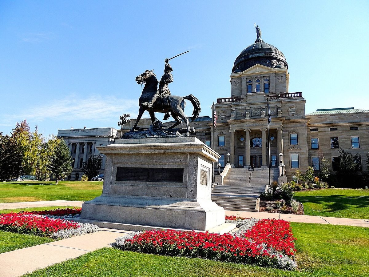
Photo: Montana State Capitol, Helena: photo by Tracey Elizabeth, CC BY 2.0, via Wikimedia Commons, resized. All photo credits.

Last updated: October 2026
Helena is Montana’s capital and the county seat of Lewis and Clark County. It began as a gold camp on July 14, 1864, when the “Four Georgians” found gold at Last Chance Gulch (Wikipedia). The gold-rush money is still visible in its Victorian buildings. Today Helena is a steady government town with a mountain park at the end of its streets.
Quick facts
| County | Lewis and Clark County |
|---|---|
| Population | 35,138 (July 1, 2025 Census estimate); 32,091 at the 2020 Census |
| Elevation | About 4,050 feet |
| Nearest commercial airport | Helena Regional Airport (HLN), about 2 miles straight-line |
| Distance to Butte | About 57 miles straight-line |
| Climate station | NOAA: Helena Regional Airport |
Sources: county from USGS GNIS; population from Census QuickFacts; elevation from the USGS Elevation Point Query Service at the town’s GNIS map point. Straight-line distances are calculated from Census Gazetteer town coordinates and OurAirports airport coordinates. Driving distances are longer.
What it’s like to live here
The Census Bureau estimates 35,138 residents for July 2025, up from 32,091 at the 2020 Census (Census QuickFacts).
As the capital, Helena is a hub for county, state and federal government. Carroll College, a Catholic liberal arts school, and Helena College University of Montana add a student presence (Wikipedia). Commutes are short, averaging 13.7 minutes (QuickFacts).
The Montana State Capitol was completed in 1902 (Wikipedia). Downtown, a renovated three-block shopping district follows the route of the original Last Chance Gulch (Wikipedia).
Things to do and see
- Mount Helena City Park. A free, 620-acre city park with six trails, including routes to the summit, which rises about 1,300 feet above town (Wikipedia).
- The Capitol and Cathedral. The State Capitol and the Cathedral of Saint Helena are two of the city’s best-known historic buildings (Wikipedia).
- Gates of the Mountains Wilderness. Managed by Helena National Forest, and the site of the 1949 Mann Gulch fire that Norman Maclean wrote about in Young Men and Fire (Wikipedia).
- Lakes on the Missouri. Canyon Ferry, Hauser and Holter lakes, plus Spring Meadow Lake State Park, are all in the Helena area (Wikipedia).
Getting around and weather
Helena Regional Airport (HLN) is about 2 miles from the city center. Helena is the driest town in this guide by precipitation, with 11.4 inches a year at the airport station. Winters are cold: the average January low is 13.5°F (NOAA, below).
Weather at a glance. These are NOAA’s 1991–2020 climate normals for the Helena Regional Airport station (monthly, annual):
- January: average high 32°F, average low 14°F
- July: average high 86°F, average low 55°F
- Precipitation: 11.4 inches a year (rain plus melted snow)
- Snowfall: 37 inches a year
Cost of living and housing
ACS 2020–2024 figures: median home value $387,300, median gross rent $1,092 and median household income $71,036 (QuickFacts). That puts Helena close to the Montana medians for home value ($375,800) and income ($72,509) (Montana).
For Zillow values and HUD rents, see the town comparison in Moving to Montana in 2027.
ACS figures are 5-year averages (2020–2024) and lag the current market. This page is general information, not financial advice.
Nearby towns
- Butte, about 57 miles straight-line. Copper-mining history, a Victorian Uptown and Montana’s biggest St. Patrick’s Day.
- Great Falls, about 71 miles straight-line. Missouri River waterfalls, Lewis and Clark history and nearly 60 miles of trail.
- Bozeman, about 78 miles straight-line. University town with ski hills on both sides and Yellowstone down the road.
- Livingston, about 95 miles straight-line. Yellowstone’s original gateway town, on the river at the top of Paradise Valley.
Sources
- U.S. Census Bureau QuickFacts: Bozeman, Missoula, Kalispell, Whitefish, Billings and Helena (Vintage 2025 population estimates; 2020 Census; ACS 2020–2024)
- U.S. Census Bureau QuickFacts: Great Falls, Butte-Silver Bow (balance), Livingston, Polson, Hamilton and Montana (Vintage 2025 population estimates; 2020 Census; ACS 2020–2024)
- U.S. Geological Survey, Geographic Names Information System (GNIS), Montana domestic names file (county and map coordinates)
- U.S. Geological Survey, Elevation Point Query Service (3DEP elevation at the GNIS map point)
- U.S. Census Bureau, 2024 Gazetteer file for Montana places (coordinates used for straight-line distances)
- OurAirports open data, airports with scheduled service in Montana (airport coordinates)
- NOAA NCEI, U.S. Climate Normals 1991–2020, Helena Regional Airport station (USW00024144): monthly normals
- NOAA NCEI, U.S. Climate Normals 1991–2020, Helena Regional Airport station (USW00024144): annual normals
- Wikipedia: Helena, Montana
- Wikipedia: Mount Helena City Park
- Wikipedia: Gates of the Mountains Wilderness
All sources accessed October 21, 2026. Wikipedia is used for general background, history and attractions. For numbers, we link the official data source wherever one exists.