
Great Falls, Montana
Missouri River waterfalls, Lewis and Clark history and nearly 60 miles of trail.
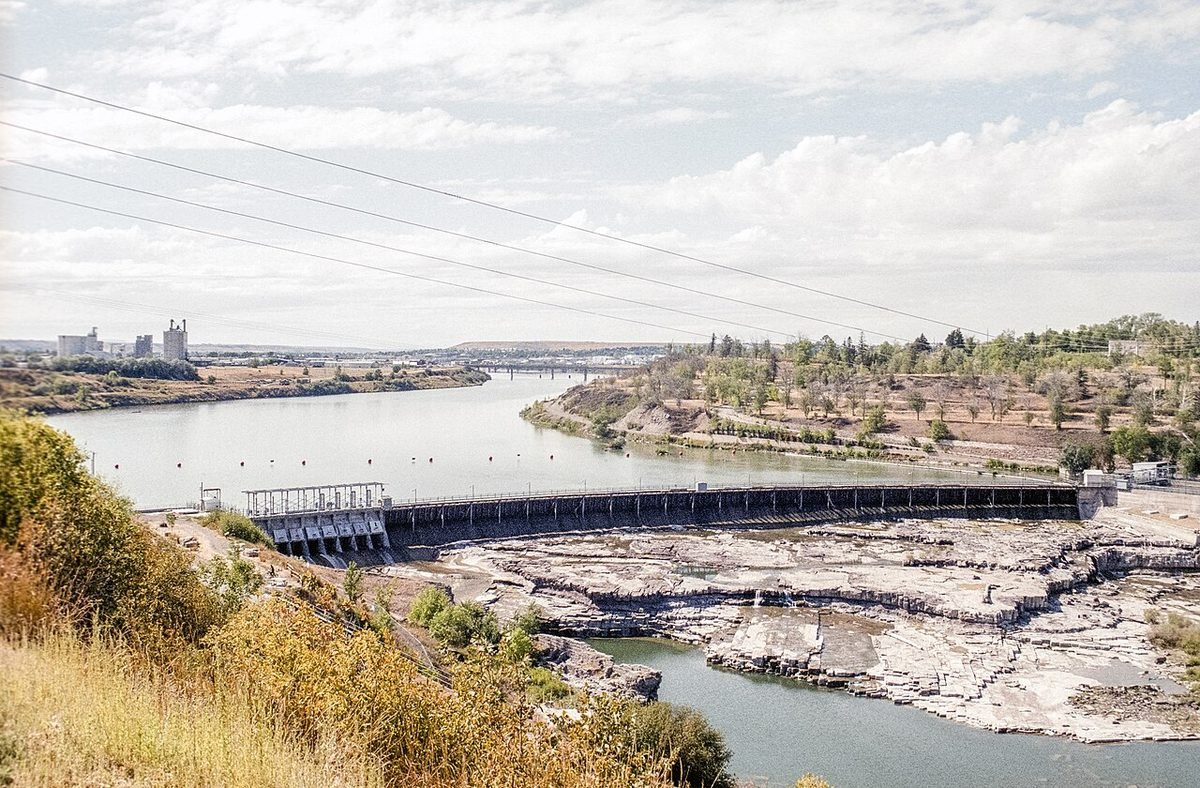
Photo: Black Eagle Falls on the Missouri River, Great Falls: photo by Acroterion, CC BY-SA 4.0, via Wikimedia Commons, resized. All photo credits.

Last updated: October 2026
Great Falls is Montana’s third-largest city and the county seat of Cascade County. It’s named for a series of five waterfalls on the Missouri River (Wikipedia). The Lewis and Clark Expedition spent 31 days here in 1805 carrying its boats and gear around the falls. Today the river is the town’s backyard, and its housing is among the most affordable of Montana’s cities.
Quick facts
| County | Cascade County |
|---|---|
| Population | 60,208 (July 1, 2025 Census estimate); 60,442 at the 2020 Census |
| Elevation | About 3,330 feet |
| Nearest commercial airport | Great Falls International Airport (GTF), about 4 miles straight-line |
| Distance to Helena | About 71 miles straight-line |
| Climate station | NOAA: Great Falls International Airport |
Sources: county from USGS GNIS; population from Census QuickFacts; elevation from the USGS Elevation Point Query Service at the town’s GNIS map point. Straight-line distances are calculated from Census Gazetteer town coordinates and OurAirports airport coordinates. Driving distances are longer.
What it’s like to live here
Great Falls has held steady rather than boomed. The 2020 Census counted 60,442 people, and the Census Bureau’s July 2025 estimate is 60,208 (Census QuickFacts). If you’re tired of bidding wars in Bozeman or the Flathead, that stability is part of the appeal.
Malmstrom Air Force Base, home of the 341st Missile Wing, is a big part of local life (Wikipedia). The city sits on the northern Great Plains next to the Rocky Mountain Front, about 100 miles south of the Canadian border (Wikipedia). Two out of three households own their homes: the owner-occupied rate was 66.1% for 2020–2024 (QuickFacts).
Things to do and see
- Giant Springs State Park. One of the largest freshwater springs in the country, producing more than 156 million gallons of water a day. It also has the Roe River, once listed by Guinness as the world’s shortest river, a fish hatchery and more than 30 miles of trails (Montana FWP).
- River’s Edge Trail. A trail system of nearly 60 miles around Great Falls, along both sides of the Missouri (Montana FWP; Wikipedia).
- Museums. Great Falls has ten, including the Lewis and Clark Interpretive Center, the C.M. Russell Museum Complex with Russell’s original house and studio, and the Montana Museum of Railroad History (Wikipedia).
- First Peoples Buffalo Jump State Park. A National Historic Landmark near Ulm, described as possibly the largest buffalo jump in North America (Wikipedia).
- The Sip ‘n Dip Lounge. A downtown tiki bar in the O’Haire Motor Inn and a local institution (Wikipedia).
Getting around and weather
Interstate 15 serves the city (Wikipedia). Great Falls International Airport has four passenger airlines (Wikipedia). Glacier National Park’s eastern entrance is about 180 miles away, and Yellowstone is 264 miles (Wikipedia). Commutes are short, averaging 14.9 minutes (QuickFacts).
Weather at a glance. These are NOAA’s 1991–2020 climate normals for the Great Falls International Airport station (monthly, annual):
- January: average high 35°F, average low 15°F
- July: average high 84°F, average low 51°F
- Precipitation: 14.8 inches a year (rain plus melted snow)
- Snowfall: 66 inches a year
Cost of living and housing
ACS 2020–2024 figures: median home value $257,000, median gross rent $900 and median household income $63,373 (QuickFacts). Those housing figures are well under the Montana medians of $375,800 and $1,081 (Montana).
See how Great Falls compares on Zillow values and HUD rents in Moving to Montana in 2027.
ACS figures are 5-year averages (2020–2024) and lag the current market. This page is general information, not financial advice.
Nearby towns
- Helena, about 71 miles straight-line. The state capital, born in a gold rush on Last Chance Gulch.
- Bozeman, about 126 miles straight-line. University town with ski hills on both sides and Yellowstone down the road.
- Butte, about 128 miles straight-line. Copper-mining history, a Victorian Uptown and Montana’s biggest St. Patrick’s Day.
- Livingston, about 132 miles straight-line. Yellowstone’s original gateway town, on the river at the top of Paradise Valley.
Sources
- U.S. Census Bureau QuickFacts: Great Falls, Butte-Silver Bow (balance), Livingston, Polson, Hamilton and Montana (Vintage 2025 population estimates; 2020 Census; ACS 2020–2024)
- U.S. Geological Survey, Geographic Names Information System (GNIS), Montana domestic names file (county and map coordinates)
- U.S. Geological Survey, Elevation Point Query Service (3DEP elevation at the GNIS map point)
- U.S. Census Bureau, 2024 Gazetteer file for Montana places (coordinates used for straight-line distances)
- OurAirports open data, airports with scheduled service in Montana (airport coordinates)
- NOAA NCEI, U.S. Climate Normals 1991–2020, Great Falls International Airport station (USW00024143): monthly normals
- NOAA NCEI, U.S. Climate Normals 1991–2020, Great Falls International Airport station (USW00024143): annual normals
- Wikipedia: Great Falls, Montana
- Montana FWP: Giant Springs State Park
- Wikipedia: First Peoples Buffalo Jump State Park
All sources accessed October 21, 2026. Wikipedia is used for general background, history and attractions. For numbers, we link the official data source wherever one exists.