
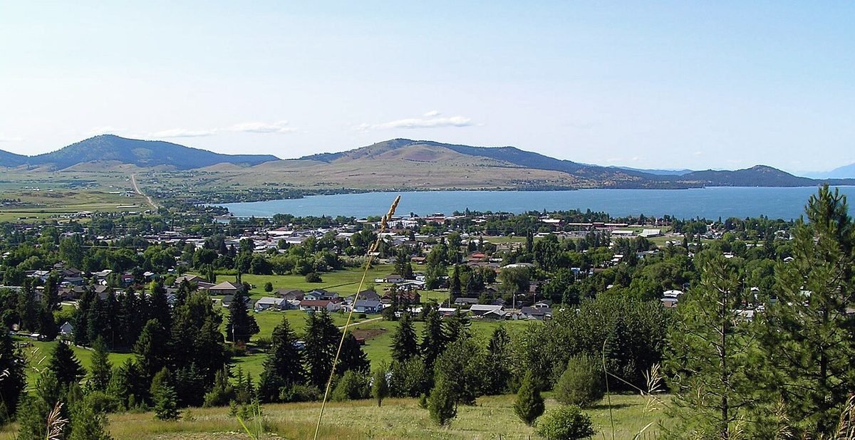
Polson, Montana
Lakeside town at the south end of Flathead Lake.
Photo: Polson and Flathead Lake: photo by Montanabw, CC BY-SA 3.0, via Wikimedia Commons, resized. All photo credits.

Last updated: October 2026
Polson sits on the southern shore of Flathead Lake, within the Flathead Indian Reservation. It’s the county seat of Lake County (Wikipedia). Montana’s tourism office describes it as the center of a fertile farming area and a prime cherry-growing region (Visit Montana). For lake lovers, it’s hard to beat.
Quick facts
| County | Lake County |
|---|---|
| Population | 5,653 (July 1, 2025 Census estimate); 5,148 at the 2020 Census |
| Elevation | About 2,930 feet |
| Nearest commercial airport | Glacier Park International Airport (FCA), about 43 miles straight-line |
| Distance to Kalispell | About 37 miles straight-line |
| Climate station | NOAA: Polson |
Sources: county from USGS GNIS; population from Census QuickFacts; elevation from the USGS Elevation Point Query Service at the town’s GNIS map point. Straight-line distances are calculated from Census Gazetteer town coordinates and OurAirports airport coordinates. Driving distances are longer.
What it’s like to live here
The Census Bureau estimates 5,653 residents for July 2025, up from 5,148 at the 2020 Census (Census QuickFacts). Polson is on the Flathead Indian Reservation, home of the Confederated Salish and Kootenai Tribes. The dam at the lake’s outlet, now called Seli’š Ksanka Qlispe’ Dam and formerly Kerr Dam, is operated by the Tribes (Wikipedia; Wikipedia).
The lake shapes the weather. It moderates the climate, so winters are less cold and summers less hot than in nearby areas (Wikipedia). The NOAA station in Polson has the mildest January lows in this guide, averaging 22.0°F (below). The town skews older: 24.8% of residents are 65 or older (QuickFacts).
Things to do and see
- Flathead Lake. It’s the largest natural freshwater lake in the western U.S. and one of the cleanest lakes of its size and type in the populated world (Wikipedia).
- Wild Horse Island. A 2,160-acre state park reachable only by boat. You might see bighorn sheep, mule deer, bald eagles and a handful of wild horses. It’s day-use only, and no pets are allowed (Montana FWP). Because it’s on the reservation, fishing there requires a tribal license (Montana FWP).
- Whitewater and the river. The Flathead River flows out of the lake at Polson and is used for whitewater rafting (Visit Montana).
- Local museums. The Polson-Flathead Historical Museum and the Miracle of America Museum (Visit Montana).
- CSKT Bison Range. The tribally managed bison reserve has its entrance at Moiese, off U.S. 93 (Wikipedia).
Getting around and weather
U.S. 93 runs through town (Wikipedia). Glacier Park International Airport is the nearest commercial airport, about 43 miles straight-line. Missoula’s airport is about 53 miles. Kalispell is about 37 miles straight-line to the north, around the lake.
Weather at a glance. These are NOAA’s 1991–2020 climate normals for the Polson station (monthly, annual):
- January: average high 33°F, average low 22°F
- July: average high 83°F, average low 53°F
- Precipitation: 15.0 inches a year (rain plus melted snow)
NOAA doesn’t publish a snowfall normal for this station, so we’ve left snowfall out rather than guess.
Cost of living and housing
ACS 2020–2024 figures: median home value $356,300, median gross rent $912 and median household income $53,418 (QuickFacts). Lakefront property is a different market from these citywide medians.
No full Polson guide yet. Our Kalispell & Flathead Valley guide covers the north end of the lake. Polson is in Lake County, not Flathead County, so its tax and utility details differ.
ACS figures are 5-year averages (2020–2024) and lag the current market. This page is general information, not financial advice.
Nearby towns
- Kalispell, about 37 miles straight-line. The Flathead Valley’s hub, 31 miles from Glacier National Park.
- Whitefish, about 53 miles straight-line. Lake, ski mountain and Amtrak depot in one small town.
- Missoula, about 56 miles straight-line. Western Montana’s river city and home of the University of Montana.
- Hamilton, about 99 miles straight-line. Bitterroot Valley county seat with the Daly Mansion and canyon trailheads.
Sources
- U.S. Census Bureau QuickFacts: Great Falls, Butte-Silver Bow (balance), Livingston, Polson, Hamilton and Montana (Vintage 2025 population estimates; 2020 Census; ACS 2020–2024)
- U.S. Geological Survey, Geographic Names Information System (GNIS), Montana domestic names file (county and map coordinates)
- U.S. Geological Survey, Elevation Point Query Service (3DEP elevation at the GNIS map point)
- U.S. Census Bureau, 2024 Gazetteer file for Montana places (coordinates used for straight-line distances)
- OurAirports open data, airports with scheduled service in Montana (airport coordinates)
- NOAA NCEI, U.S. Climate Normals 1991–2020, Polson station (USC00246635): monthly normals
- NOAA NCEI, U.S. Climate Normals 1991–2020, Polson station (USC00246635): annual normals
- Wikipedia: Polson, Montana
- Wikipedia: Flathead Lake
- Montana FWP: Wild Horse Island
- Visit Montana: Polson
- Wikipedia: CSKT Bison Range
All sources accessed October 21, 2026. Wikipedia is used for general background, history and attractions. For numbers, we link the official data source wherever one exists.