
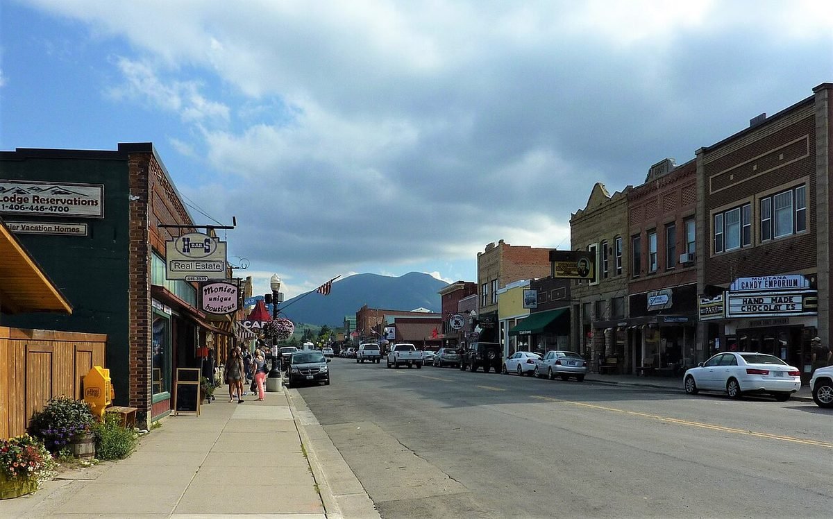
Red Lodge, Montana
Mountain town at the start of the Beartooth Highway.
Photo: Downtown Red Lodge: photo by Chris06, CC BY-SA 4.0, via Wikimedia Commons, resized. All photo credits.

Last updated: October 2026
Red Lodge is the county seat of Carbon County. It sits right against the Beartooth Mountains, with Rock Creek along its eastern edge (Wikipedia). Coal built the town, and the Beartooth Highway made it a gateway to Yellowstone. Today it’s a small mountain town with a historic downtown, a ski hill and the start of the Beartooth Highway, an All-American Road (Wikipedia).
Quick facts
| County | Carbon County |
|---|---|
| Population | 2,723 (July 1, 2025 Census estimate) |
| Elevation | About 5,570 feet |
| Nearest commercial airport | Billings Logan International Airport (BIL), about 55 miles straight-line |
| Distance to Billings | About 53 miles straight-line |
| Climate station | NOAA: Red Lodge |
Sources: county from USGS GNIS; population from Census Bureau population estimates; elevation from the USGS Elevation Point Query Service at the town’s GNIS map point. Straight-line distances are calculated from Census Gazetteer town coordinates and OurAirports airport coordinates. Driving distances are longer.
What it’s like to live here
Red Lodge is too small for Census QuickFacts, but the Census Bureau’s population estimates put it at 2,723 residents for July 2025 (Census population estimates). Coal mining defined the town from the late 1800s until the 1930s. The 1943 explosion at Smith Mine #3 near Bearcreek, which killed 74 men, was the worst coal mine disaster in Montana history (Wikipedia).
The town fills up in summer, when visitors arrive by way of the Beartooth Highway (Wikipedia). Red Lodge also has a 4% resort tax (Montana Resort Tax Association), explained in Does Montana Have Sales Tax?. Beartooth Billings Clinic provides local medical care (Wikipedia).
Things to do and see
- Beartooth Highway. An All-American Road on U.S. 212 from Red Lodge to Yellowstone’s Northeast Entrance. It tops out at 10,947 feet at Beartooth Pass and is usually open only from about mid-May to mid-October (Wikipedia).
- Red Lodge Mountain. An alpine ski area on the eastern front of the Beartooths, west of town (Wikipedia).
- Year-round outdoors. Skiing, mountain biking, fly fishing and backpacking are all nearby (Wikipedia). The Custer Gallatin National Forest surrounds the town (Visit Montana).
- Granite Peak. Montana’s highest point is about 30 miles southwest of town, in the Custer Gallatin National Forest (Wikipedia).
- Downtown. A historic main street with locally owned shops and restaurants, plus the Carbon County Historical Society and Museum (Visit Montana).
Getting around and weather
Billings Logan International Airport is the nearest commercial airport, about 55 miles straight-line, and Billings is the nearest big city. Red Lodge is the snowiest town in this guide. The NOAA station in town averages 141.9 inches of snow a year (below). Expect real winter driving.
Weather at a glance. These are NOAA’s 1991–2020 climate normals for the Red Lodge station (monthly, annual):
- January: average high 38°F, average low 14°F
- July: average high 81°F, average low 50°F
- Precipitation: 22.7 inches a year (rain plus melted snow)
- Snowfall: 142 inches a year
Cost of living and housing
Census QuickFacts doesn’t publish housing data for towns under 5,000 people, so the closest official figures are for Carbon County. The ACS 2020–2024 county median home value was $420,800, median gross rent $844 and median household income $80,261 (Census QuickFacts, Carbon County). In-town prices may differ.
For taxes, including resort tax, see Does Montana Have Sales Tax?.
ACS figures are 5-year averages (2020–2024) and lag the current market. This page is general information, not financial advice.
Nearby towns
- Billings, about 53 miles straight-line. Montana’s largest city, set beneath the Rimrocks on the Yellowstone River.
- Livingston, about 71 miles straight-line. Yellowstone’s original gateway town, on the river at the top of Paradise Valley.
- Bozeman, about 94 miles straight-line. University town with ski hills on both sides and Yellowstone down the road.
- Helena, about 165 miles straight-line. The state capital, born in a gold rush on Last Chance Gulch.
Sources
- U.S. Census Bureau QuickFacts: Carbon County, Montana (ACS 2020–2024)
- U.S. Census Bureau, Vintage 2025 city and town population estimates for Montana (SUB-EST2025_30)
- U.S. Geological Survey, Geographic Names Information System (GNIS), Montana domestic names file (county and map coordinates)
- U.S. Geological Survey, Elevation Point Query Service (3DEP elevation at the GNIS map point)
- U.S. Census Bureau, 2024 Gazetteer file for Montana places (coordinates used for straight-line distances)
- OurAirports open data, airports with scheduled service in Montana (airport coordinates)
- NOAA NCEI, U.S. Climate Normals 1991–2020, Red Lodge station (USC00246918): monthly normals
- NOAA NCEI, U.S. Climate Normals 1991–2020, Red Lodge station (USC00246918): annual normals
- Wikipedia: Red Lodge, Montana
- Wikipedia: Beartooth Highway
- Wikipedia: Red Lodge Mountain
- Visit Montana: Red Lodge
- Montana Resort Tax Association: Communities Overview
All sources accessed October 21, 2026. Wikipedia is used for general background, history and attractions. For numbers, we link the official data source wherever one exists.